About us

Prakshep Tech Solutions is a Geospatial Services company specialising in the collection, analysis, presentation and delivery of geospatial information. We digitise the real world for business and government. From vast expanses of landscape down to individual pieces of machinery, we capture it all. Our depth of resources provides the flexibility to adapt our methods to specific project needs. We then help our clients manipulate it, analyse it, and profit from it.

Our strength lies within our people. Our clients are our lifeblood and our consultants are committed to developing innovative solutions to solve unique business challenges and add value.

Whatever the scope of your geospatial information technology needs, We have the expertise and the experience to meet it.

How Lidar Works

Our services

Geo spatial data processing and mapping

Geo Spatial data processing can be very resource intensive and complex, since it usually involves the analysis of large amounts of spatial and non-spatial data from various diverse applications, and can additionally incorporate the dimension of time. We at Prakshep Tech Solutions are well trained in data processing. We do accurate and pin point data processing and mapping for various applications. Spatial data processing utilizes large volumes of geodata to answer business questions, identify risk and solve critical problems.

3D GiS and Visualization

We have expertise in  3D Mapping and Visualization. Applications include developmental planning processes like examining the visual impacts of development and shadow analysis. They also deliver complex decision support through simulations such as traffic flow and flood risks. Our models have even been used to identify vantage points and plan crowd management for firework spectaculars. The simulation ability of our system brings the fourth dimension, time, into play changing geospatial data from a descriptive tool into an analytic tool.

Aerial Survey and LiDAR

Prakshep Tech Solutions has the resources, experience and expertise to deliver cost-effective, fit-for-purpose solutions for your enterprise , or engineering requirements. Accurate terrain  and image products are delivered via the cloud or other customised requirements which maximise your investment in these key foundation data sets.  Aerial imagery provides a record of the earth’s surface at an instant in time and is relied on by all organisations that manage or interact with the natural and built environments. Aerial imagery provides a common language to help communicate complex concepts or problems to developers, planners, decision makers and society at large.

See some more services

What else we provide?

3D City Models

Prakshep Tech Solutions prides itself on efficiency in capturing, processing and delivering our 3D datasets to our clients in a variety of ways

Laser Scanning and 3D Modelling

Prakshep Tech Solutions  is an early adopter and investor in laser scanning, 3D modelling . We employ these technologies to survey the current status of the built environment and to enhance future design, construction and ongoing management.

Satellite Imagery

Digital Elevation Models, Bare Earth Digital terrain models, Contours, Vegetation indices.

Do you want to…

Take some time and meet our Employees?

...or maybe see some Facts about us?

Some Facts about us

Projects
98
Surveys
125
Clients
57
Industries Served
25

Hear it from our Clients

We look forward to work with Prakshep Tech Solutions and is always a pleasure doing business with them, We are satisfied with their work quality, dedication and quick turn around time.

James Stevens REM Group of Companies

Archaeological Structures like menhirs were successfully extracted through the help of Prakshep Tech. We recommend them!

John Doe

LiDAR Data Processing

Prakshep Tech Solutions has various expertise services under the LiDAR technology and providing services through out the world. Based on the platform of data collection by the scanners, our expertise's are classified into the following types:

  • Airborne LiDAR
  • Mobile Terrestrial LiDAR
  • Terrestrial LiDAR
  • UAV ( Unmanned Aerial Vehicle)
ALS MLS LiDAR
87%
TLS LiDAR
93%
LiDAR Ortho
77%
Data Processing
82%

WANT TO KNOW MORE ABOUT OUR COMPANY? CURIOUS WHAT ELSE WE DO?

Latest news about LIDAR

How is LiDAR used?

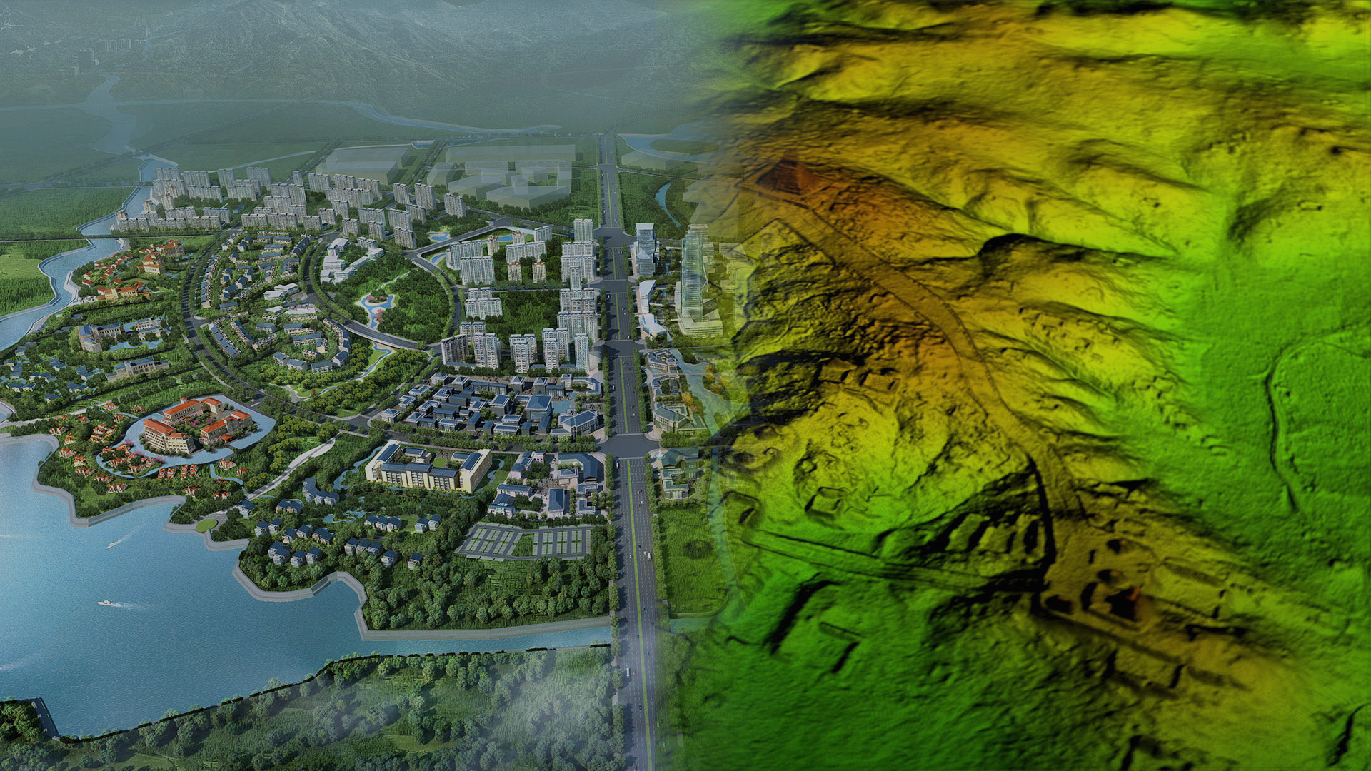
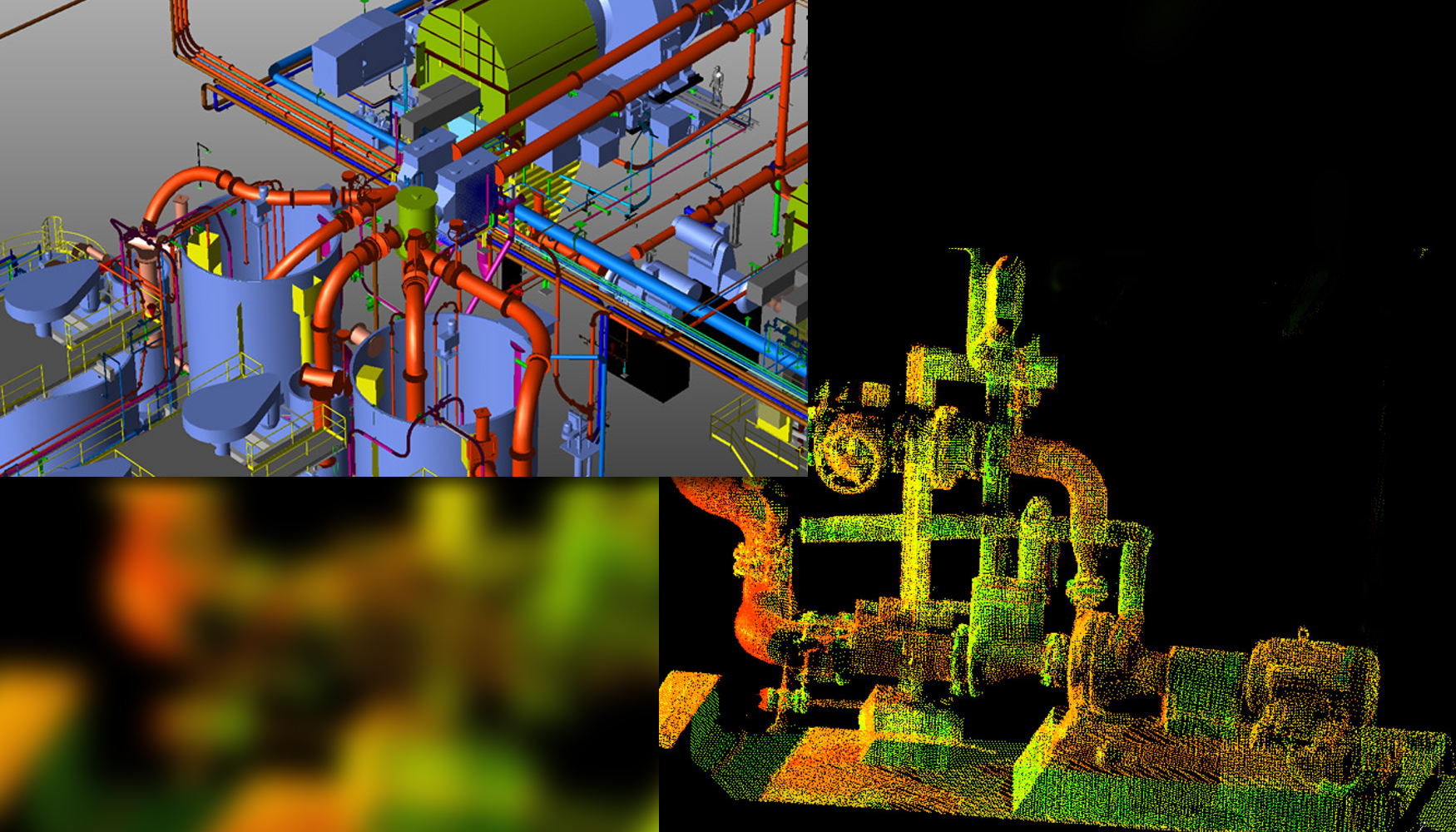
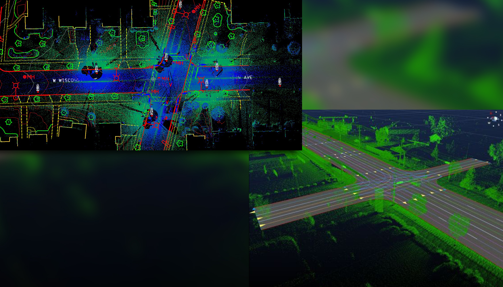
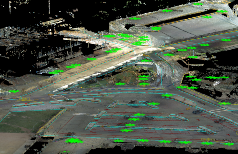
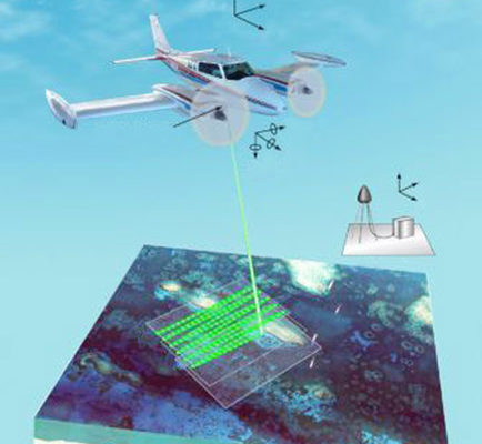
LiDAR has a wide range of applications. It depends on the wavelength that’s being used, the detector that’s being used, as well as the platform that it’s being used on. One of the biggest applications of airborne platform for LiDAR is wide-area mapping. Using a LiDAR sensor that’s flying at a certain height or an […]

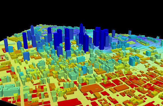
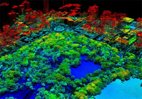
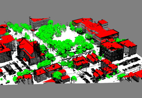
How cities are scanned using LiDAR Technology?

Researchers at New York University have refined the procedure, resulting in much more detailed images. LiDAR can be used in different fields to benefit communities around the world. When attached to any aircraft, it receives space and time data about the surface below. The data can later be studied for archaeological purposes or applied to […]

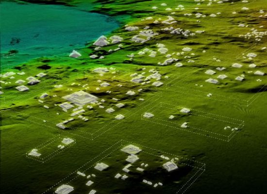
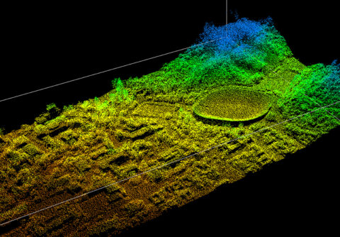
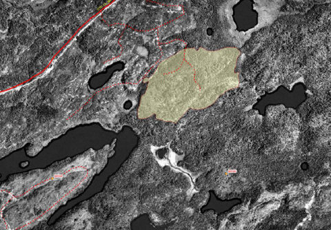
Lost Mayan City discovered with the help of LiDAR

IT’s been there some 1200 years. But it’s been hidden from sight by the dense green foliage of Guatemala’s tropical rainforests. It’s an ancient Mayan civilisation capable of having housed more than 100,000 people. But it took modern laser technology (known as LiDAR — Light Detection and Ranging) and a survey of more than 2100 […]

See all our news